|
|
|
| Note: The building of this page and the many related pages sure to follow is a long-term working project. My intent is to journal all of our 1800+ cache finds over the last 10 years, as well as keep up with the cache finds in the future. Check back often as things continuously change through the writing and construction process. Enjoy! |
 |
Our Geocaching adventures began April 17, 2004 in Helena, Montana. I cannot recall where I heard about it, but when I presented the idea to Penny, she was all for it. We ordered GPSs on-line (yes, we bought 2 GPSs—a pair of Garmin eTrexs—to avoid the "let me do it; it's my turn! " conflicts), created a handle at geocaching.com, and within a week were on our first cache search in a great little game that would keep us adventuring for years, take us to places we would otherwise never have gone, and make us bunches of new friends.
By-the-way, our handle in the beginning was "Paddock2". After a time we realized how uninspiring that was and changed it to
"Frogwarts & Bearfr" and have carried that as
our handle/signature ever since. |
 |
|
|
Our first cache was called "Birds Of A Feather." It was a multi-part puzzle cache; a tough one for newbies, but we didn't know that at the time. We had no idea what we were getting ourselves into, but after about an hour of flailing around inside the airport breaking out the clues, and another two deciphering and tracking down the other parts and other clues, we were hooked. Here is our first log:
[log] This was our first cache and it was a lot of fun with a puzzle and decrypting. Living in the area we thought we knew about where the cache would be and then were a bit surprised when it was entirely somewhere else. Then, we couldn't find it after walking past it a half dozen times. We spotted a red dice within a foot of it and thought that it had been vandalized and the dice was all that was left. Then, just when we were about to give up, Penny spotted it. Our GPS had gotten us within 10 feet. We took a CD (Great folk music) and left the dice, an address book, a tape measure/level, and a sea shell from South Carolina.
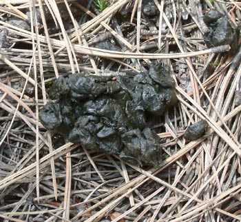
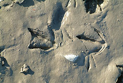
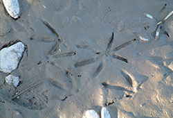
| We didn't obtain any pictures on this first caching adventure, not realizing how into this we were going to get. Eventually, we would wind up carrying two cameras, his and hers. Most of the animal pictures belong to James. Most of the flower pictures belong to Penny. Everything else we often don't remember who gets the credit. Check out this great picture of animal poop on the right, better known as scat. Yes, we really did take that picture and many more just like it. Pretty exciting, no doubt!! |
 |
[top] |
|
And so we headed off to our second cache, becoming rather excited that we managed two caches in one day. With each cache we learned. On this one we learned to wear hiking shoes, to set a waypoint at the car so we can find our way back, and to be prepared for anything, and also to carry maps.
[log] This was the second of two caches today. We put the location into our eTrex and started the approach from the Southwest. We got as close as .8 mile (the instructions said .1 mile). We should have suspected something right then, but adventurous as we are, we parked and headed out. Fortunately we set a waypoint on the car or we would still be wandering around out there. It was still easy travel until we arrived to within 800 feet - above it. What was a basic 2 in difficulty up to that point suddenly turned into a 4. By the time we located it and then trekked our way back to the car, we were whipped. We took a bag of cat stickers and left a bear. This would have definitely been easier if we had started from somewhere north of the city, in the Valley.
This is our GPS tracking map for our first two caches, Birds of a Feather and Buck or Less 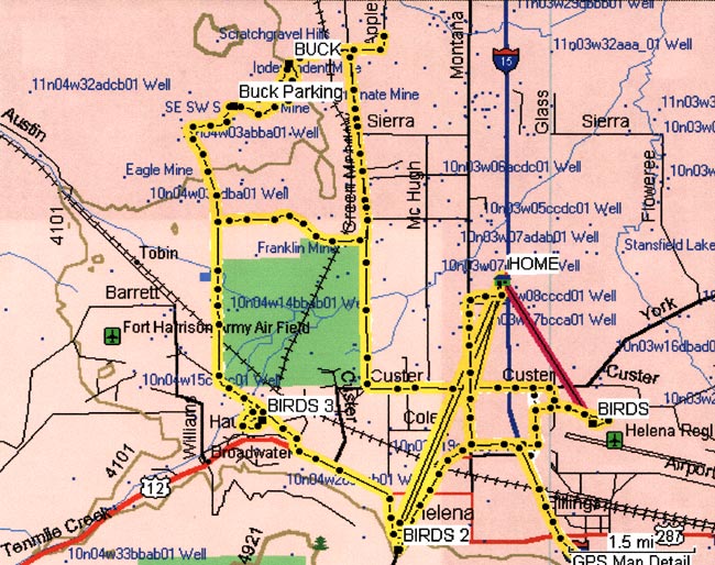
|
|
The following Saturday, April 24th, we headed out again, our GPS's loaded with new adventures, our camera loaded with, ah, a chip. This one took us south toward Clancy, and then up Lump Gulch Road into the mountains.
[log] Nice cache but a bit difficult for the hiker-challenged. We could have parked closer if we had our topo maps, which we did but didn't know it till later. We took the power bar (Penny needed it) and the spider ring and left a CD by Colin Raye "Extreme". Penny thought the name was very appropriate. It was a nice 1.3 mile hike in and 1.9 mile hike out. Don't know how my GPS got us in the wrong direction. The view from the final location was great.
 |
 |
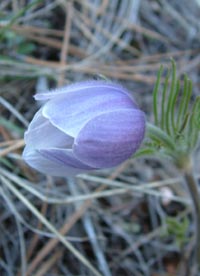 |
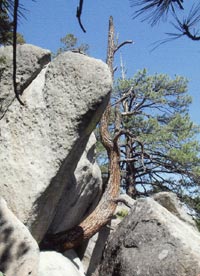
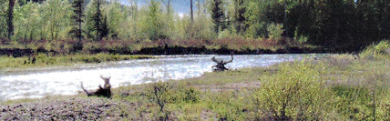
We started out on foot following the bearing line straight over and around all the granite boulders. The woods were gorgeous, filled with huge pines and tiny purple pasque flowers and shooting stars. After a few misses we found the cache nudged in a crevasse at the top of a group of bus-size granite boulders, part of Sheep Mountain. Our route back got a little off track and we wound up hiking a half mile farther than we needed to, and then we made our first geocaching friend. A mountain biker came up the dirt track with his dog huffing and puffing to keep up. The dog--she introduced herself as Zelda--stopped to say hi, weighing chasing after her master or taking a slow strole with us. For about a half hour we had ourselves a canine friend. When we got back to the car we didn't know what to do with her. The mountain biker was somewhere up the trail, so noting that she had a phone number on her tag, we decided to take her with us until we got to cell phone range. Just before pulling onto Lump Gulch Road, we had to wait for a car to pull in. The woman driver seemed to recognize our passenger. We stopped; she stopped. It was the wife of the biker, and the mother of one of Penny's junior high school students. All ended well. We said so long to Zelda, went home, sat in the hot tub and planned our next adventure searching for treasures in beautiful Montana back-country.
[log note July 13, 2 months later] I'm logging in to help soylentpink straigten out the .999 Fine Travel Bug; he notes on the Travel Bug page that he logged it in Granite in error, but no longer had the number to fix the error. I went out to check our Buttermilk Gulch cache this morning to see if it was really there, which it is. So rather than emailing the number needed over the net, I will simply move it for him.
|
|
| |
 |
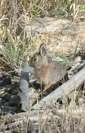
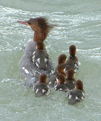
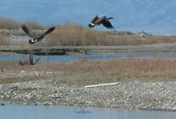
We headed out the next day following the GPS east on Hwy 12. 40 minutes later we were gazing across a lazy marsh, trying to figure out how to get to the other side. The GPS pointed to some high ground so we got back in the explorer and started searching our way around on the back roads until we found ourselves within two-tenths of a mile of the cache. From there it was on foot into the brambles, and piles of driftwood. Canadian geese announced our arrival; a bunny rabbit watched us for a few seconds and then scrambled into the brush. A couple of wrong turns and then a few right turns and we were looking down at the cache. We traded our treasures, signed the log, and knew for certain that we had stumbled onto one of the best kept secret pastimes of modern day. |
 |
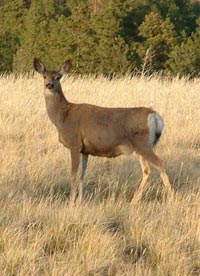
[log] Excellent location for a cache. The sounds of birds were constant with Canadian geese really letting up a fuss when we got close. Saw two white-tail deer. Probably saw the same rabbit (got picture) that Jennifer and Dean saw so we had to take the bunny erasers. Also took the belt clock. Left a miniature set of taro cards.
|
| |
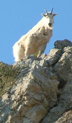 |
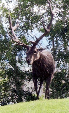
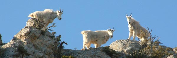
It was a week before we hit it again, having to put up with those blasted weekday jobs. If we weren't already hooked into Geocaching, this one did it. Wildlife was in abundance, photographic opportunities at every turn. The herd of mountain goats was probably the highlight. We spotted them on the way out, in the foothills where the grazing was likely sweet and tender. I leaped from the car with my camera and took off into the field to gain better photographic angles while Penny watched from the roadside. I felt like a kid again.
The herd scrambled up onto the rocks and turned to pose, or eyeball this strange creature shadowing them. As they were a bit quicker at the rock climbing than was I, I grabbed these last few pictures and waved them on. They didn't wave a thank you, but seemed to understand and disappeared beyond the ridge. |
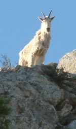 |
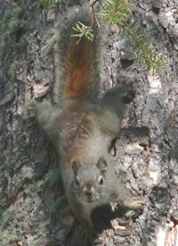
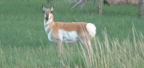
[log] We had to get out the paper topo map to look for roads to this one since we inadvertently loaded the metro maps instead of the topo maps into the GPS. We took some plastic bugs and a pink flamingo pin, and left a reset pin and a rain forest candle. it was a fabulous wildlife trip; we saw a duck, many beaver dams (no beavers), a bluebird, a grouse, squirrels, a woodpecker, numerous whitetail deer, elk droppings, bear scat, and a herd of 17 mountain goats. Got great pictures of the goats.
|
|
 |
[top] |
|
|
It was two weeks before we managed to get the GPS's fired up again. There is a certain pride, a bragging right you might say, to being the first to find a cache. We woke up Saturday morning, May 15, to a new cache listing south of Helena and no one had logged a find yet. "Why not us?" we voiced to each other, quickly pulled our morning together, and hurried out the door for what would become our very first, first-to-find (FTF), and our very first Travel Bug.
[log] A wonderful cache and our first, first. We picked up the .999 travel bug (also a first for us) and hope to place it somewhere that it can do a lot of traveling. The day was absolutely perfect with temps in the mid to high sixties. We took the magnetic nail clippers and left the glow in the dark stars to go with the blacklite that was already there. Thanks to Buck-or-Less group for another great Cache.
Travel Bugs add another layer to the game, a step-up in the excitement. This particular Travel Bug (TB) was attached to 1-ounce of silver. It's goal was to travel the country in hopes of being photographed in front of each of the US Mints, or to go overseas and be photographed in front of the mints of other countries. Sadly, for reasons too numerous to mention, many TBs go missing after a time. .999 travel bug went lost in Germany in May of 2006 after logging 11,460.3 miles. Of the 17 TBs that we, Frogwarts & Bearfr, started over the years, only 5 are currently (April 2009) still on the move. More about our Travel Bugs in later episodes.
 |
|
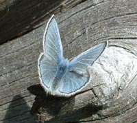 |
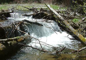
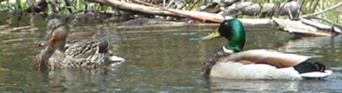
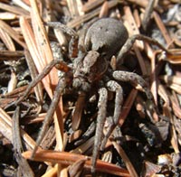
| For a time Buck or Less Too had us wandering around, second guessing our GPSs, but hurrah, we found it and sure enough, we were the First to Find. We signed the log book, noting our trades and enjoyment at the opportunity to be the FTF, and then spent the next hour or so exploring the area. Over the years we have found that the fun is not just the geocaching, searching and finding treasures with our GPSs; it's the adventures we discover along the way, such as a little, blue butterfly that danced around us and then lighted on a stub of an old log long enough to be photographed, a spider which we knelt down and analyzed like a couple of children, though we didn't scoop it into a jar and take it home to show mom, or a pair of ducks that lazed in a wide spot in a nearby creek (we love anyplace that has water) , occasionally dipping their heads to see what delectables await their dining delight in the murkiness below. |
|
|
| |
|
Not every Geocaching adventure goes well. Kickapoo 2 in Montana left us with some definite memories, a mixture of wonderful experiences, and one disaster.
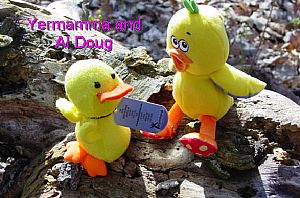
[log]  Not only did we find this cache, but it had the Al Doug Travel Bug. It has been on its way to San Antonio, Texas, so we are going to try our best to get it pointed in that direction. This was a beautiful hike, again an area we have never been to. There were some massive snow banks which were easily avoided, or walked across. They were very solid. Not only did we find this cache, but it had the Al Doug Travel Bug. It has been on its way to San Antonio, Texas, so we are going to try our best to get it pointed in that direction. This was a beautiful hike, again an area we have never been to. There were some massive snow banks which were easily avoided, or walked across. They were very solid.  I dropped my camera and broke it. UGGGGG! It was still a great cache. We took the $5,000,000 Turkish Lirasi Note and left a Screw Driver set. I dropped my camera and broke it. UGGGGG! It was still a great cache. We took the $5,000,000 Turkish Lirasi Note and left a Screw Driver set.
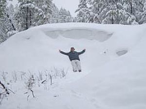
1 week later: Because we keep a scrap book of all our found caches, and I dropped and broke my camera on the way to this one, we had to go back and get pictures. Unfortunately it snowed last night on McDonald Pass and we had to push upwards of five inches of snow to get to it.
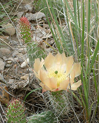
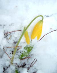
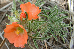
Penny wanted pictures of some of the flowers in the area and despite the snow, she got them. Had to do a little digging around to find them. (See pics) Despite the snow (only a month until the beginning of summer) it was a great day for a hike.
|
|
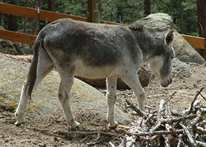
| Some caches are assigned a theme by the cache owners. Rimini Snowflake had to do with snowflakes. The owners asked that snowflake related items be traded. On the way up the back country road we came upon this billy goat meandering along. He didn't appear to be looking for a ride so we admired his fine beard, took his picture and moved on. The mule we spotted later was in a fenced area. He was a bit more shy of the camera than the billy goat, but we managed to sneak this candid shot. |
 |
 |
[log] This was a nice, easy hike to this cache. Came across a billy goat about a mile from the camping area. Appeared to be wild but a bit out of place. We took the bookmark and left a Snowflake Rhyme scrapbook sticker.
[top] |
|
|
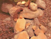
We dressed for the weekend intermittent rain, clamored into the Explorer and headed south on I-15 toward Butte. We were tired of being couped up in the house and the sculpture walk seemed as good an excuse as any to fire up the GPS's and "get out of Dodge." We took the High Ore Road exit, midway between Boulder and Basin, slowly picked our way along a very unmaintained road, stopping several times to admire and photograph Boulder River raging along next to us. It was Spring and the mountain snows were melting. We found a place to park reasonably close to the cache coordinates, turned our backs to the river and started walking the old Milwaukee railroad bed. It was along there where locals, hikers, and visitors had 'sculpted' with native rocks and other man-made materials. Impressed by these works of art, Geocacher jowens planted a cache, Basin Sculpture Walk, to bring the Geocaching community there to witness the artists' endeavors, and maybe create their own. We did just that, or rather Penny did. She built a sculpture, which she titled "The Butterfly." We then did our Geocache thing: found cache, traded items, signed log, rehid cache.
 |
Basin Sculpture Walk came into this world August 17, 2003, and then found its way into cache heaven October 3, 2004, a short life for most caches. For whatever reason—vandals, locals deciding it was time to put the fun away—the sculptures were destroyed sometime during the summer of '04. Jowens, the cache owner, chose to archive the cache that had been dedicated to the art.
[log] A wet, rainy day, but we made it to the cache in between showers. The sculptures along the trail were interesting, so we left behind our own. We took hematite rock and a butterfly stamp, and left a sparkly bear and two bug rings. Thanks for the cache and bringing us somewhere we have never been. |
| [top] |
|
|
|
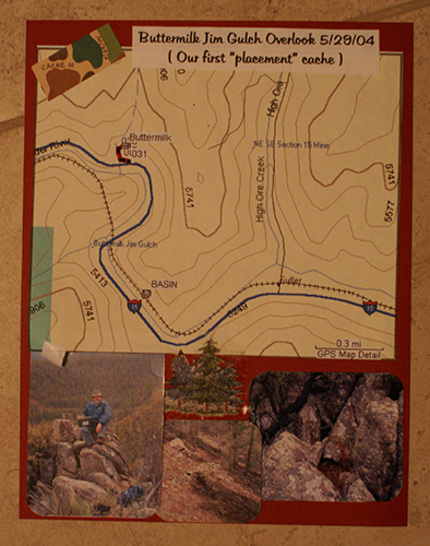
When we finished up with Basin Sculpture Walk we weren't ready to go home. The rain had let up a little so we followed the road a bit farther and then took a side road, parked and started exploring on foot. We headed along a path, a gentle climb up a ravine, until we came to an old cabin, circa early 1900s or late 1800s was our guess. We poked around, took some pictures, explored, until I got a brilliant idea. Ideas are my forte; not to say Penny doesn't get them, but I get many more. The difference between us is that she acts on them. Normally they just gurgitate inside my head until they turn to mush and disappear. Once I voice an idea, though, and Penny likes it, she will invariably be the one who puts it into action.
"Why don't we start our own cache?" I said, having absolutely no clue how to go about doing that. Before it turned to mush she said, "Yeah," and then I said "Yeah." The yeah's had it and we continued our exploring with a whole new goal in mind. Although the cabin area seemed perfect at first, we ended up following a couple of deer trails back toward the Explorer and then up until we were on an outcropping that overlooked the gulch and the river. This was the perfect spot. We took numerous notes and GPS readings and then headed home.
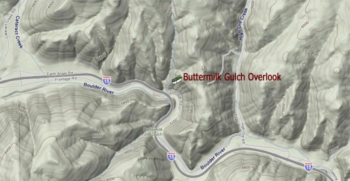
After analyzing the area on the on-line topo maps we chose to call the cache Buttermilk Gulch Overlook, in honor of the name of a gulch that could be seen, Buttermilk Jim Gulch. Somewhere we acquired an old ammo box, hit the dollar store, and loaded up our first cache. The following Saturday we headed back down I-15, took the High Ore exit, parked and climbed, and then planted our first cache, still under the handle "Paddock2". Needless to say, it was a very exciting day. We rushed home and submitted it to Geocaching.com and waited anxiously for it to be published. The next night, May 30, 2004, it went live and then we waited to see who would find it first, that is, who would become the FTF on our first cache.
[cache description] Short 0.1 mile hike on an overgrown man-made trail. Elevation change is 180 feet.
The access is a short hike suitable for children along a packed trail with great scenic views of Bull Mountain and Buttermilk Jim Gulch. Entire trail is on BLM land.
The cache is a green ammo box. Original contents are: Logbook with Penci/sharpener, Montana postcard, Mini calendar, Calculator, Crow Flitter Critter, Yo-Yo, Cowboy Statue, Barrettes, Blue Ice, & Table Tennis Sport Balls.
[The hint] Take High Ore exit from I-15. Continue South; take the Non-maintained cattle access road. Park at N46 16.182 W112 13.078. Walk up the old dirt road to the sign marked, "Locked Gate Ahead." 10 yards past look right to see rock-sided trail.
The log from the First-to-Find:
 June 2, 2004 by Packyfan (30 found) June 2, 2004 by Packyfan (30 found)
[WARNING: This paragraph has clues about the cache.] I loved the hike and the view. It was kool to be the first ones to find it. It took me the good part of an hour to find it, but the burnt wood gave it away. This cache should have a harder difficulty and terrane. I fell down a couple of times and scratched my legs and got bit by knats. We took the crow football and the blue ice and left the necklace and bookmark. Thanks for this wonderful cache. We had a great day. We took the crow football and the blue ice and left the necklace and bookmark. Thanks for this wonderful cache. We had a great day.
And then this:
 June 12, 2004 by TWO4GEOFUN (3414 found) June 12, 2004 by TWO4GEOFUN (3414 found)
3 of us Searched for 1/2 hour and No Luck. GPS had us to 1 ft. Terrain should be higher than a 2.
Noting that the first finder had some difficulty and a later geocacher couldn't find it at all, we decided that we needed to modify the description.
6/13/04 -- We've found that a few have felt that the difficulty level was higher than indicated. After some thought we have come to the conclusion that they are approaching it from the wrong direction. We need to be clearer. Start on the trail, just up the dirt-track road from the parking location (see hint). Once on the trail, remain with it for three switchbacks. After the third switchback follow your GPS directly to the cache. Look for the rock formations. Do not leave the trail early or you will wind up with a difficulty level of 4. You don't need to rock-climb here.
In the fall of 2006, as we prepared to depart Montana for the warmer climate of Southern Arizona, we adpoted out (or archived) all of the caches that we owned. The number had climbed to 60. Buttermilk Gulch Overlook was kindly taken over by mjstef and continues to this day providing Geocachers a wonderful view of Bull Mountain, Buttermilk Jim Gulch, and the raging (sometimes) Boulder River.
[cache log in memory of our great friend yumitori, master of the haiku]
A summertime strole,
Along a sun-dappled trail;
Passing squirrels fuss.
[top]
|
|
 |
We couldn't just sit around the house while waiting for Buttermilk Overlook to be published. We were still trying to break in our GPSs, so we headed out Sunday morning, taking Highway 12 to Avon and then 141 North toward Helmville. Our first charge was to find our way into the Ogden Mountains of Helena National Forest, east of the highway. What a wonderful drive and great views. |
 |
[log] What a workout getting to this one but the views were well worth it. For some reason we didn't realize it was a theme. The closest thing we had to "First Aid" in our goodie bag was a candle. I know, it's a stretch. We left it anyway and took nothing.
[top]
|
|
And then it was on to our first Red Hot Mama cache. There is a lot more to Geocaching than running out with your GPS and logging a hidden treasure, or even where you go to find these hidden treasures (our pictures can attest to how fantastic that is). There are the hidden treasures behind the hidden treasures . . . the cool people behind the handles, like Red Hot Mama. We logged many caches with her name on them and with each one we became more and more curious about this "Mama" who called herself "Red Hot." We each, Penny and I, formed our own picture. Weren't we surprised when we finally learned more about her, and her daughter and son-in-law, Leonata & Yumitori and then finally met her. More about this fantastic, awe inspiring lady and her awesome family in later chapters.
 |
Once we made it out of the mountains, the drive and hike
to Button, Button were a little less vertical challenging. We parked next to Browns Lake,
eye-balled some Muggles who we hoped weren't
eye-balling us, and took an easy stroll
to the cache. |
 |
[log] Easy drive to fun theme cache. Walked right up to it laying on the ground. Took a wooden leaf button. Left a purple dragonfly button. Hid the cache back where we thought it was originally. This was the second of four caches today.
[top]
|
|
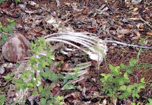
Previous logs on this cache reported a stench from an elk that had been butchered near one of the campsites and very close to the cache. Fortunately the stench was gone, but sun-bleached bones, and ragged remains of hide were still in evidence. We took pictures and kept a wide birth as we searched for the cache. Once found, traded and logged we explored along the Black Foot River.
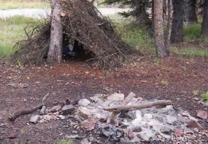
We came upon a camp made up of a dead fire ring and an interesting tent-like shelter made of gathered twigs and branches. Inside the shelter was clothing. We got no closer than to take a picture, not sure if the clothing was a sleeping person. We whispered our way by just in case. |
 |
[log] Very difficult to find because our GPS never showed closer than 30 feet,and we never found the rock. Still, we circled until we stumbled onto the cache. Great hiding place. Elk smell is gone but four skeletons remain. We bottomed out the four-wheel drive so we recommend walking in from the parking on Hwy 200. Was a beautiful spot along the Black Foot River. Wonderful pinewood and river aromas. Took the Indonesian Paper money. Left the Al Doug travel bug and a small spotted frog. We will come back to explore the area a little more in the summer.
[top]
|
|
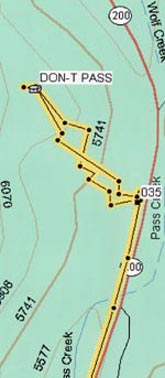 |
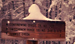
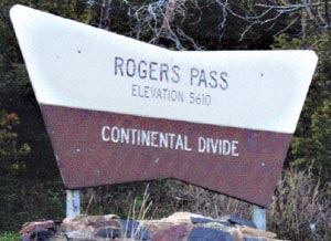
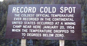
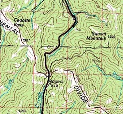
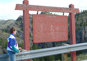
The final cache of this Memorial Day weekend took us up to Rogers Pass on the Continental Divide. As we noted the "Record Cold Spot" sign telling us it was 70° below zero in 1954, we were quite pleased that on our visit it was better than 130° warmer.
The altitude was 5610 feet when we started up the Continental DivideTrail. The 3100 mile trail, which starts in the Chihuahuan Desert of southern New Mexico and ends at the Canadian border in Montana's Glacier National Park, rises to over 13,000 feet, so our little portion at less than half that altitude was barely noticable. Still, it zig-zagged back and forth until we were within 100 feet or so of the cache at just over 6000 feet; not a tremendous climb by any means unless you're a serious couch potato. Doing this might help us from becoming that. |
 |
|
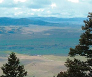
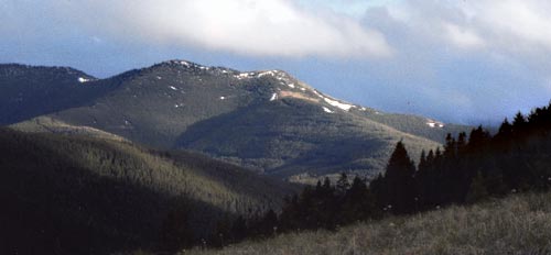
We turned off trail, up a side-hill, and spent several minutes locating the cache, and then looked northeast across Sunset Mountain, a small piece of the Helena National Forest, itself a small piece of the Rocky Mountains. Although we took pictures and enjoyed the views, I don't think we ever took the time to truly appreciate the beauty of Montana's Big Sky Country. From Yellowstone National Park south to Glacier National Park north, to the mountains in the west and the plains in the east—Wyoming to Canada, Idaho to North Dakota—Montana is an abundance of visual resources.
|
 |
 |
[log] Great hike up nice trail on Roger's Pass. Many mountain flowers in evidence. Walked right up to the cache. This was our fourth and last cache of the day. Took the "I Love My Cat" key chain. Because the cache was low, we left a Winnie The Pooh key chain, a Marc Anthony CD, a small army helicopter, and the .999 travel bug. This is one any cacher would enjoy.
[top]
|
|
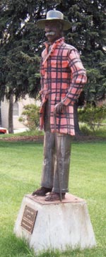 |
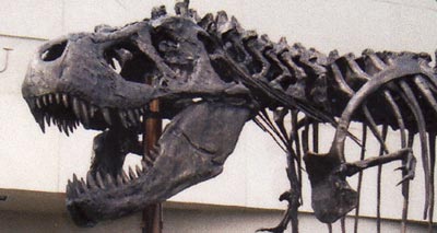
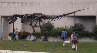
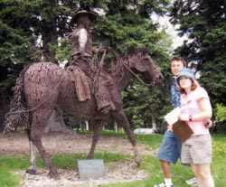
Some caches turn into all-day events. Such is the case with Statues Times Ten, a 10-stage multi. We drove over to Bozeman from Helena with the sole purpose of picking up Penny's daughter, Jamie, and her boyfriend, Gabe, and showing them what Geocaching was all about. As the name implies, there were 10 statues (except one was missing for restoration, which we didn't know about at first). With each statue we learned the clue to the next statue and gained a piece of the puzzle to assemble the coordinates for the final . . . the actual cache. Luckily Gabe was a Bozeman local and had a little inside knowledge on the statues. One of our miscalculations took us into the mountains south of the city, not exactly where we were supposed to be, but it was a nice drive. The coolest, I thought, was Tyrannosaurus Rex in front of the Museum of the Rockies. AWESOME!
All in all it was a great day with the kids. |
 |
 |
[log] It took us 3-1/2 hours with miscalculating twice and ending up in some unsuspecting neighborhoods. Is there truly a statue missing or did we miss count and not see it? We never went back to check but one of our foursome deducted that that was the case. Great guess. We picked up daughter and her boyfriend for this one (their first cache) and they had a great time. The cache itself was so well hidden that even with two GPS trying to out-do each other, it took a good twenty minutes to find it. Yours truly, one of us without the GPS, stumbled onto it. We took a hologram sticker, left a staple puller and a Lewis & Clark Postcard. Thanks Don and Nancy for the tremendous dedicated effort at putting this one together. |
[top]
|
|
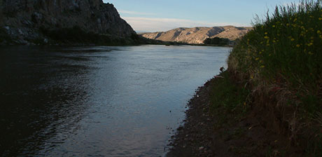
How many times in your driving around your county or state have you sort of noticed something but never took the time to investigate ? That's what it was with the location of the Missouri River Overlook Cache. There was a small pull-off and parking area on I-15, southbound from Great Falls to Helena. Neither of us, I born and raised in Montana, Penny having lived here going on 30 years, had ever seen this spot. Less than a five minute walk (walking slow) we found a wonderful bird's eye view of the Missouri River as it meanders through the mountains, supplying the blood of life to farms and ranches, as well as small and large communities across the country before it joins up with the Mississippi to continue to the Gulf of Mexico. |
 |
 |
[log] How many times have we driven by this and not noticed the climb to the overlook? What a wonderful view. We took The Collector TB, left the Lewis & Clark Postcard and a Elk Postcard. Thanks Gary & Bernie for a great location.
[top] |
|
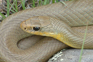
Penny, an avid quilter, had a quilting event at a country home north of Great Falls. I dropped her off and went in search of the Sacajewea Springs Cache. Now and then names come along that we just love feeling them roll off our tongue. Sacajewea is just such a name. It's a pleasure to say and the cache was a pleasure to find. The dirt road took my past Ryan Dam and along the Missouri River. Plant and wildlife were in abundance along and in the river, including this fine specimen of a snake. Don't worry, I wasn't as close as the picture seems. I had my trusty zoom lens along. Although I was somewhat certain it wasn't poisonous (definitely wasn't a rattlesnake) I still like to maintain my distance. |
 |
 |
[log] This was a wonderful hike in. Saw rabbits, hundreds of birds, a snake (non-poisonous), a small but impressive waterfall, and numerous flowers. Took a sea shell and the Joe Dalton TB. Left a Cookie Monster key chain and change purse. Thanks for a great location for an afternoon hike.
[top]
|
|
|
Geocaching was still in its growing pains when The Ulm Cache was hidden on November 18, 2001, less than 18 months after Dave Ulmer hid the very first cache outside Beavercreek, Oregon, May 3, 2000. Within the month the term Geocaching was coined by Matt Stum on the GPS Stash Hunt mailing list. The activity evolved over the next four months until September 2, 2000, when Geocaching.com was launched and a great new game took on a public face. At that time there were 75 known caches in the world. At the time of this writing, June 2013, there over 2.1 million caches hidden and more than 5 million registered Geocachers.
[log] With a little effort we walked right up to the area of this one and then spent a half hour stomping around looking for it. I was close to giving up but Penny was persistent. We took the rabbit key chain (maybe to add to a TB we picked up earlier in the day) and left two Toy Army Vehicles to go with the travel bug that was already there. Thanks for the cache.
[top] |
|
|
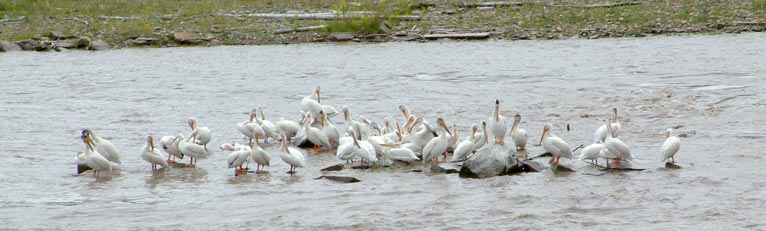
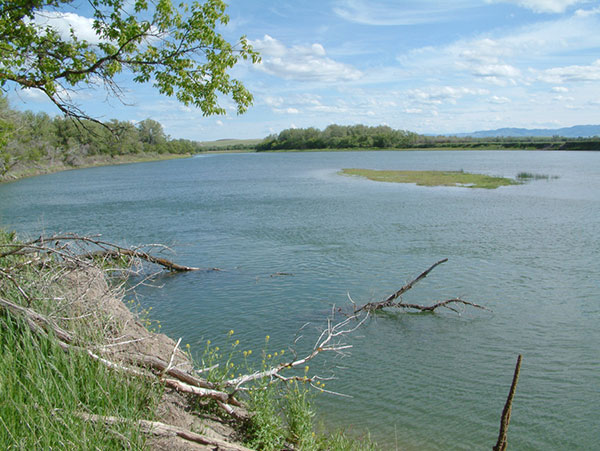
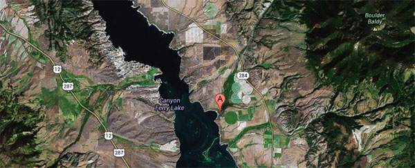
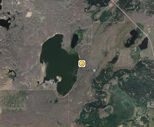
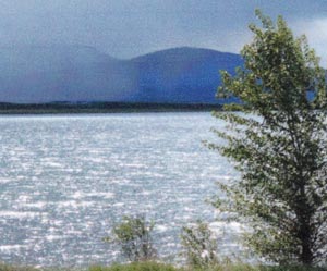
Near the Confederate Campground along the shores of Canyon Ferry Lake made this one of our favorite caches. Bring us to a lake, river, stream, fountain in the middle of a big city, anywhere there is water, and well be happy. OK dont let your GPS get on the WRONG side of the creek for this cache; the trick is finding the right side!
[log] This was our fourth cache of a very busy day and we were pushing dusk. Fortunately our GPS took us right to it (first from the wrong side of the creek) and it was only a few minutes of poking around before we spotted it. We took the bookmark and left a set of magnetic numbers. As in all the caches we have found, we have discovered another cool area we have never been.
[top]
|
|
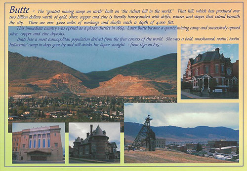
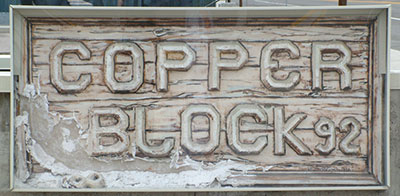
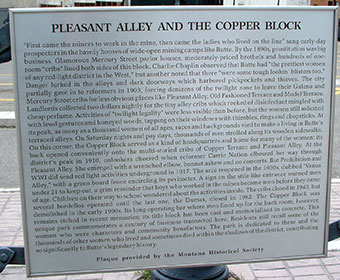
What can I say about Butte, Montana, the city in which I was born, at one time called the Richest Hill on Earth? For a handful of generations Butte was one of the largest cities west of the Mississippi, growing from 24,000 in 1890 to 60,000 in 1920. It still sports the 1 on its license plates, signifying the highest county population in Montana at the time such numbers were distributed. Butte boasts much rich and diverse history, one being the Ladies in Pleasant Alley on the Copper Block. One can get a great history lesson and tour of the Dumas Brothel. Started 1892, it became known as the longest running brothel in United States history, shut down in 1982 as the result of tax violations.
In 2005 we took Pennys 8th grade class on a geo-tour field trip from Clancy, Montana to Butte to help them gain a bit of Butte history via the Geocaching game. They and we had a great time, though, with impressionable 13 and 14-year-olds, we had to tip-toe past the Dumas Brothel.
All in all it was well worth the trip to do all the Butte history caches. |
 |
[log] Great site for a cache. The biggest challenge was searching for it with two boys sitting six feet away having a conversation. Managed to snag it anyway. We were just a couple of weird toursits acting even weirder. Wonderful history. Traded the Maryland quarter for a Florida quarter.
[top] |
|
| It was during the boom time of the copper, gold and silver-laden mountains around Butte, Montana that three men fought for control of Butte's mining wealth, they being William A. Clark, Marcus Daly, and F. Augustus Heinze. It was Daly who joined with Rockefeller and others to form what is now known as Anaconda Copper Mining Company, becoming the dominant mining company in the area. Laborers, often with families, arrived from all over the United States as well as Cornwall, Ireland, Wales, England, Lebanon, Canada, Finland, Austria, Serbia, Italy, China, Syria, Croatia, Montenegro, and Mexico. Many, if not all, of those nationalities still reside in a around the old city, my own being Italian, Irish and Fin. The awesome info on the history of the Copper Kings can be found at http://en.wikipedia.org/wiki/Copper_Kings and Tammany Castle history is worth checking out at
www.dupontcastle.com/castles/tammany.htm. This was some challenging research on the Web combined with on-site virtual cache stops
to make for a really unique cache hunt. |
[log] Very interesting history lesson. However, the online research was a bit more challenging. Persistence paid off and Penny found the answers. Thanks, Marty, for putting this one together, and Jennifer & Dean for managing it.
[top]
|
|
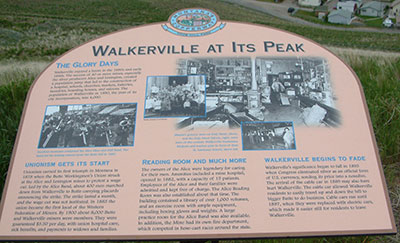
"I know where it is," I said as I rushed to a collection of three boulders in Nob Hill Park, the highest point in Walkerville, a small community on the northern edge of Butte. Black clouds were rolling in from the east and lightning strikes (not good when at such a high point) had us picking up our feet a little faster. With a quarter mile hike from the parking, and another quarter mile back, we were a bit worried. When I turned around to see if Penny was behind me, she was stopped some twenty feet back, the cache in her hand. Apparently, I'd almost stepped on it. With no time to waste, we signed the log and hoofed it out of there. We were in the car when the first drops hit. This was such a unique hide for this location that we brought Penny’s 8th grade geocachers here in 2005 on a "geo-hunt" field trip to “teach them a new way to look.”
Incorporated in 1890 with a population of 4,000, now with a population 675 and part of the Butte-Anaconda Historic District, Walkerville, an old mining town on the edge of a bigger old mining city, holds a lot of childhood memories for me. It was where I spent the first three years of my life at the turn of the mid-century, on Daley Street, and where I have recollections of the streets and hills around my parent’s 2-story home, now gone. It was also to where my parents and I returned for many visits to my grandparents.
It was the "silver in them there hills," that brought Walkerville to life with schools, churches, markets, bakeries, laundries, boarding houses, saloons and a hospital. The boon didn't last long. In 1893, just 3 years after incorporation, Congress eliminated silver as an official form of U.S. currency and the bottom fell out of the market. As transportation means improved, the residents started going down into Butte to shop and Walkerville receded to a basic bedroom community, as it still exists today and in my memory. |
 |
[log] Because we read the logs, and Penny was on top of the "think out of the box" thing, she walked right up to it and picked it up while I was busy searching in the wrong place. That was lucky because black clouds with lighting and thunder were racing across the mountains from the east. Not a good thing when you're the highest point around. We entered the log and ran for it. Thanks for a great cache. Wish we had had time to linger.
[top] |
|
 |
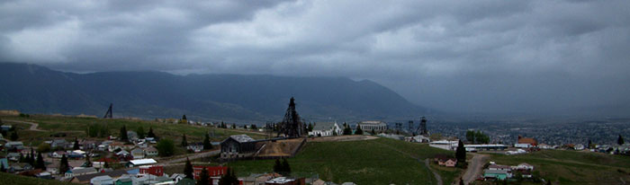
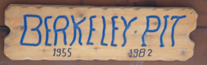
Laden with heavy metals and dangerous chemicals, and one of the largest Superfund sites in the United States, Berkeley Pit lies one mile long by half a mile wide and 1,780 feet deep. The level of water in the pit, with an acidity of lemon juice, a 2.5 pH level, sits at roughly 900 feet. Imagine a big swimming pool loaded with arsenic, cadmium, zinc and sulfuric acid. I was 6 years old when the shovels started digging this open pit copper mine, a boon to the local economy and a huge source of jobs. Over the 27 years that the mine was open and running an estimated 1 billion tons of material was mined from the pit, gradually consuming much of Butte’s east side; working class homes, businesses and schools. In the early 80’s my grandparents home was targeted for absorbsion by the Berkeley Pit mining operation. Anaconda Co. bought them out, providing a home on the “Flats” as the lower valley in Butte was referred to. Their home for as long as I can remember, where I learned to ride a bicycle and mow a lawn, where I helped my grandmother pick tomatoes, sweet peas and corn, were I spent many a Chrismas and a few summers, was raised until nothing was left but dirt. Shortly after, all mining operations were stopped. In the end the only home in my grandparents neighborhood that was torn down, was theirs. |
In 1995, a flock of migrating snow geese landed in the Berkeley Pit water and died. 342 dead geese were recovered. Although it was claimed that the deaths had nothing to do with the water, that the birds were infected by a grain fungus, tests by the State of Montana revealed that their insides were lined with burns and festering sores from exposure to high concentrations of copper, cadmium, and arsenic.
Since closing operations in 1982, groundwater from the surrounding aquifers began to slowly fill the pit, rising at the rate of about one foot a month. It is estimated that by 2020 the level will reach the point that it will start spilling into local groundwater, 5410 feet above sea level, thus threatening the residents of Silver Bow County. Hopefully, all the efforts put forth since declaring the pit a Superfund site in the 90's will avert this now looming disaster. |
[log] It has changed considerably since I was last here six years ago. Thanks for the reason to return.
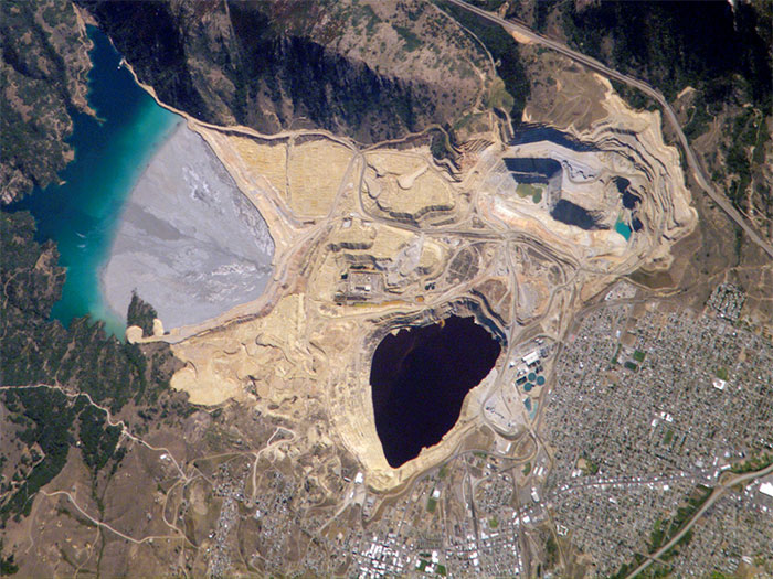
Astronaut photograph ISS013-E-63766 was acquired August 2, 2006, with a Kodak 760C digital camera using an 800 mm lens, and is provided by the ISS Crew Earth Observations experiment and the Image Science & Analysis Group, Johnson Space Center. The International Space Station Program supports the laboratory to help astronauts take pictures of Earth that will be of the greatest value to scientists and the public, and to make those images freely available on the Internet. Additional images taken by astronauts and cosmonauts can be viewed at the NASA/JSC Gateway to Astronaut Photography of Earth. |
[top] |
|
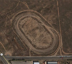 |
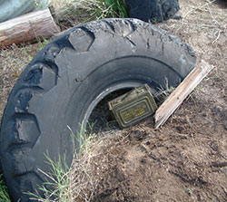
This cache raised some memories of my childhood in the 1950's when I would go here with my parents when we visited relatives in Butte. I looked around at the dilapidated bleachers and discarded tires and could visualize old jalopies racing for all their worth.
If you’ve searched too long for this cache, you might not be spelling the word properly- try “tire”d. |
 |
[log] After 45 minutes of searching the entire area we decided this one was our first no-find. We spent the next couple of hours hitting the other caches in Butte and then on our way out decided to try it again. BINGO! It was right where we both looked at least four times each. How the heck did we miss it? Persistance pays. We took the yellow Lotus Sports car and left an Army Convertible and an Ace Hardware truck. Thanks for the cache.
[top] |
|
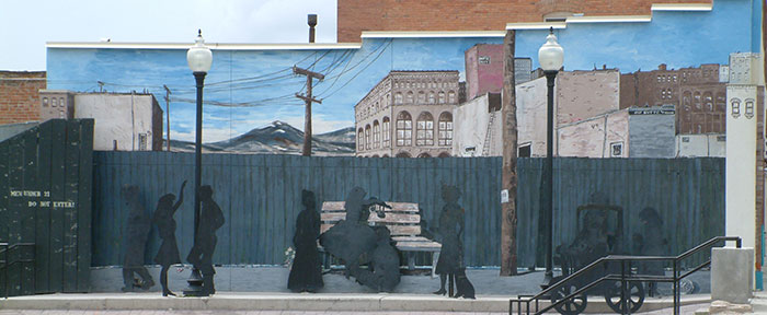
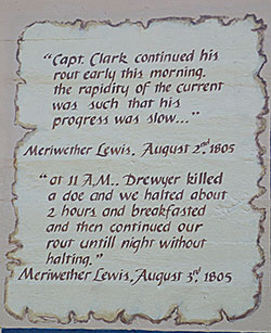
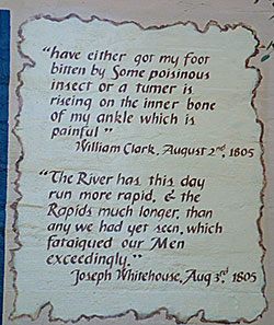
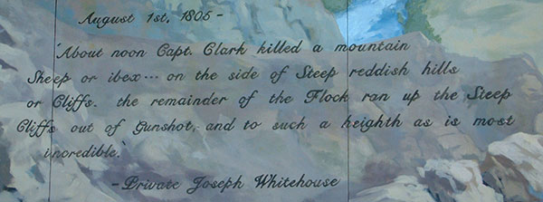
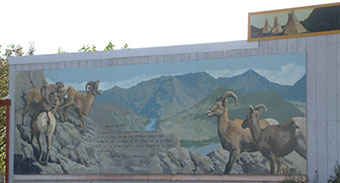
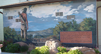
[log] Found this one as part of a 7-cache day between Butte and Three Forks. Great Murals. Didn't take long to find the cache. It was a lot smaller than I expected and was surprised by the log. Super idea.
[top] |
|
|
 |
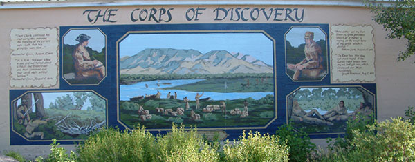
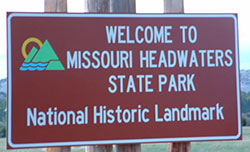
The Gallatin, the Jefferson and the Madison make up the Three Forks of the headwaters of the Missouri. Where else can you find gorgeous wildflowers, pictographs, and interesting historical murals as well as a great cache. Interpretative guides were available also. World famous fly-fishing, by-the-way, so bring your gear. |
|
 |
[log] This was the last in a 7-cache day, and the best. Unfortunately we ran into dusk. We will return later in the summer to explore the entire park and surrounding area. We found it with no problem, partially because it was totally exposed as we approached it. We took a feather and left a small pocket knife. Great day for caching (except for the brief thunder and lighting storm in Butte). Thanks Don and Nancy for bringing us here.
|
 |
[top] |
|
|